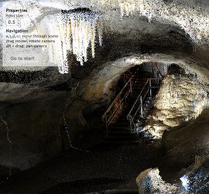
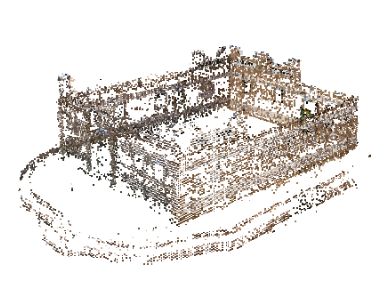
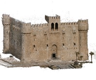
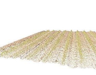
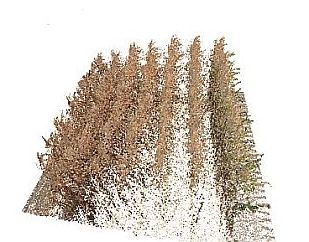
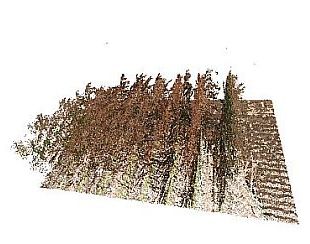
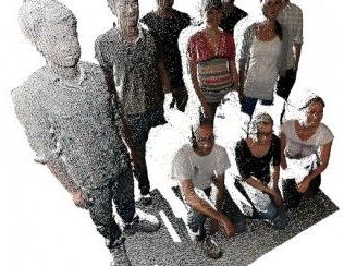
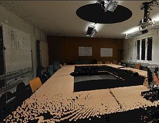
View Point Clouds in your Web Browser

This website presents examples of point clouds visualizations using the new HTML5 WebGL technology. Just click on the examples below to get started.
All you need to watch it is an WebGL enabled browser (runs best on Mozilla Firefox or Google Chrome).


Dechen-Cave (Iserlohn): Pulpit-Grotto

Dechen-Cave (Iserlohn): Pulpit-Grotto

Visit one of the oldest public speleothem caves of Germany, the Dechen-Cave (German: Dechenhöhle, 51° 21' 55.1" N 7° 38' 28.7" E)!
The point cloud covers the 'Pulpit-Grotto' (German: Kanzelgrotte) and was captured with a Riegl VZ-400 terrestrial laser scanner from 7 scan positions on 30th of May 2013. The group of small stalgmites that correspond to the 'Pulpit'-stalagtites was reconstructed in 3D via structure from motion [1,2,3] based on 20 images of an uncalibrated compact camera (Olympus VG110, D700). The resulting point cloud was fused with the laser scanning data in order to fill shaded areas.

[1] Changchang Wu, "VisualSFM: A Visual Structure from Motion System", http://ccwu.me/vsfm/, 2011
[2] Changchang Wu, Sameer Agarwal, Brian Curless, and Steven M. Seitz, "Multicore Bundle Adjustment", CVPR 2011
[3] Rothermel, M., Wenzel, K., Fritsch, D., Haala, N. (2012). SURE: Photogrammetric Surface Reconstruction from Imagery. Proceedings LC3D Workshop, Berlin, December 2012

Reconstruction of a traditional Nubian house, Assuan

Screenshot from reconstructed Nubian house

The 3D point cloud of a reconstruction of a traditional Nubian house (24°04'42.65''N, 32°53'23.99''E) at the Nubian Museum in Assuan, Egypt, was generated by structure from motion (SFM) [1,2] using 51 uncalibrated camera images (Olympus VG110, D700) taken on 20-01-2013.
The resulting colored 3D point cloud can be visualized in our WebGL point cloud viewer.

[1] Changchang Wu, "VisualSFM: A Visual Structure from Motion System", http://ccwu.me/vsfm/, 2011
[2] Changchang Wu, Sameer Agarwal, Brian Curless, and Steven M. Seitz, "Multicore Bundle Adjustment", CVPR 2011

Structure from Motion (SFM)

Screenshot from Fort Qaitbey Main Tower

The Citadel of Qaitbay in Alexandria (31°12'50.5''N 29°53'8''E) has been subject of testing 3D reconstruction with ordinary uncalibrated camera images using structure from motion (SFM).
VisualSFM [1,2] has been applied for coarse reconstruction, SURE [3] was used for a dense reconstruction of the southern and western facade, subsampling of the dense cloud and registration of the two clouds was done with CloudCompare [4].
The resulting 3D point cloud can be visualized in our WebGL point cloud viewer.

[1] Changchang Wu, "VisualSFM: A Visual Structure from Motion System", http://ccwu.me/vsfm/, 2011
[2] Changchang Wu, Sameer Agarwal, Brian Curless, and Steven M. Seitz, "Multicore Bundle Adjustment", CVPR 2011
[3] Rothermel, M., Wenzel, K., Fritsch, D., Haala, N. (2012). SURE: Photogrammetric Surface Reconstruction from Imagery. Proceedings LC3D Workshop, Berlin, December 2012
[4] http://www.danielgm.net/cc/

3D Maize Plants - May

Screenshot from Maize Plants in May

Two multitemporal LiDAR campaigns of a maize crop stand have been performed. Here you can view the campaign in May.
The data was acquired with a Riegl VZ-400 sensor system.

3D Maize Plants - October

Screenshot from Maize Plants in October

Two multitemporal LiDAR campaigns of a maize crop stand have been performed. Here you can view the campaign in October.
The data was acquired with a Riegl VZ-400 sensor system.

3D Maize Plants - May & October

Screenshot from Maize Plants

Two multitemporal LiDAR campaigns of a maize crop stand have been performed. Now, you can get an impression of both campaigns merged in one view using our WebGL viewer.
The data was acquired with a Riegl VZ-400 sensor system.

3D Scan of the LRG Team

Screenshot from the lrg Team Scan

This example shows our LiDAR Research Group.

Point Clouds in the Web

Screenshot from a Seminar room

This example shows one of our seminar rooms, at the Institute of Geography, University of Heidelberg.
The data was acquired with a Riegl VZ-400 sensor system.


   Heidelberg University    GIScience Research Group, Institute of Geography, University of Heidelberg
GIScience Research Group, Institute of Geography, Heidelberg University
http://www.geog.uni-heidelberg.de/gis
Website by Dipl.-Geogr. M. Auer, Andreas Kiefer & Dipl.-Geogr. Kristina Koenig