View OSM Examples in your Web Browser
This website presents examples of OSM visualizations using the new HTML5 WebGL technology.
Just click on the examples below to get started.
All you need to watch it is an WebGL enabled browser (runs best on Mozilla Firefox or Google Chrome).
3D points extracted from OpenStreetMap GPX files
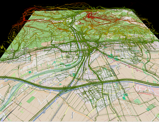
GPS data uploaded to the OpenStreetMap is collected by the project contributors primarily to support mapping. As the inclusion of roads and paths in the map is a major goal of the project, the collected GPS data often follows such man-made structures. We have extracted all points from the planet.gpx file and visualise the subset that has elevation information in Heidelberg as a 3D point cloud. There are ~1,000,000 individual GPS points in Heidelberg (planet file from 04/2013). The bounding box that was applied has a size of ~200km².
Detailed Description: Link
Visualization: Link

http://www.geog.uni-heidelberg.de/gis
Website by Dipl.-Geogr. M. Auer, Andreas Kiefer & Dipl.-Geogr. Kristina Koenig